Plitvice Lakes National Park
Stepped karst lakes and falls: a Crater Lake analog where water is the map, not a trail dump.
Maps
Park overview first. Corridor sheets add planning detail where they exist.
Park overview (Map 1)
Full map / print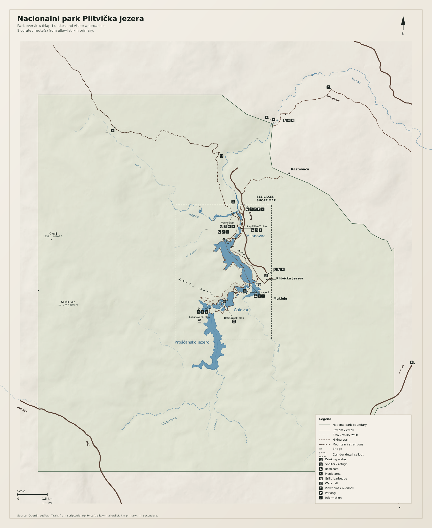
Lakes shore corridor (Map 2)
Full map / print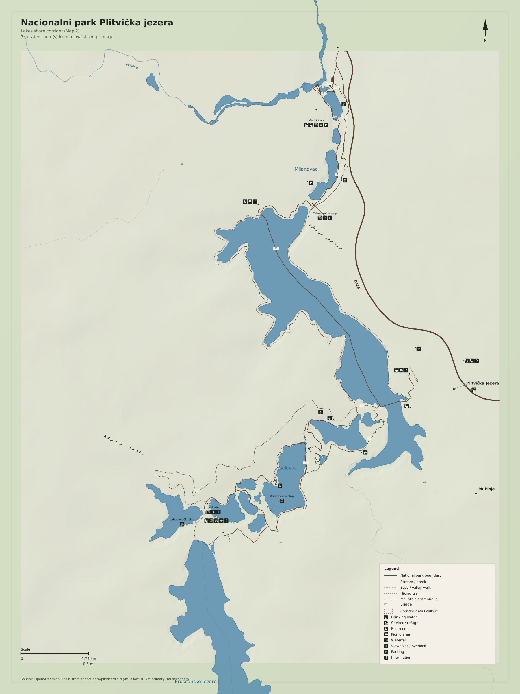
Overview
Nacionalni park Plitvička jezera is the Crater Lake analog: one hero hydro system, two gates, empty forest around it. The dashed frame is the lake chain.
Use Croatian toponyms as on the ground. Distances on the map are kilometres first, miles second.
Natural highlights
What is worth seeing on foot. Elevations in meters (and feet on the map).
Kozjak
Largest lake in the chain. Boats here are logistics between upper and lower lakes, not a cruise product on this sheet.
Veliki Slap
Great Waterfall at the lower lakes. The usual first view from Entrance 1.
Prošćansko jezero
Highest large lake in the upper chain. Quieter than the boardwalk crush between Kozjak and Milanovac.
Trailheads & parking
Where to leave the car (or bus) to get close to what you want to see.
Entrance 1 (north / lower lakes)
Large paid lots at Entrance 1. Walk to Veliki Slap. Tickets and timed entry apply in season.
Entrance 2 (south / upper lakes)
Lots at Entrance 2 / ST3 toward the upper lakes. Same ticket system.
Mukinje / Rastovača
Village overflow. Use only when the official lots are the plan, not forest pullouts.
Trails
Distances are useful order-of-magnitude figures for planning, not survey-grade GPS tracks.
Lower lakes to Veliki Slap (allowlist review)
Along the way: Veliki Slap
The busy shore. Stay on the posted program paths; this sheet is not a bushwhack map.
Upper lakes loop
Along the way: Kozjak, Prošćansko jezero
Order-of-magnitude. Seasonal closures and one-way boardwalks change; read the posted program.
Getting there
Two official entrances. The forest around the lakes is the rest of the park; Map 1 still centres the water.
By car
D1 between Karlovac and Knin; signed turnoffs to the two entrances.
By transit
Buses from Zagreb, Zadar, and Split to the park. No useful rail.
Parking
Official lots only. Overflow on the D1 is not a trailhead.
Intentionally left off
European tourism sites push these hard. This map does not, so the nature signal stays readable.
- Ticketed "experience" photography piers
- Boat-cruise marketing (boats are a shuttle on Kozjak)
- Nearby adventure parks and zip-lines