Ordesa y Monte Perdido National Park
A Pyrenean canyon park: Ordesa, Monte Perdido, and a Grand Canyon-style overview with a valley callout.
Maps
Park overview first. Corridor sheets add planning detail where they exist.
Park overview (Map 1)
Full map / print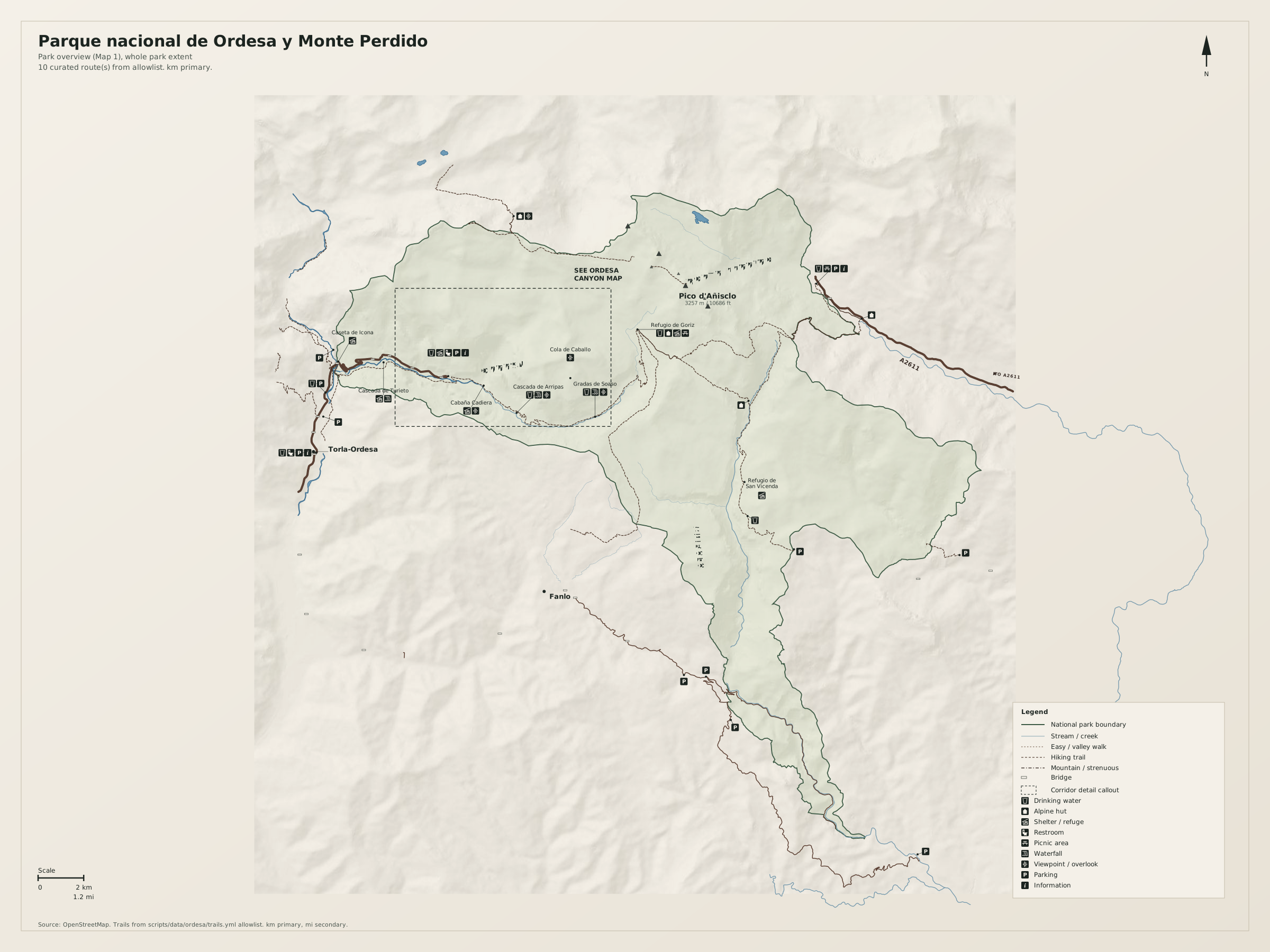
Ordesa canyon floor (Map 2)
Full map / print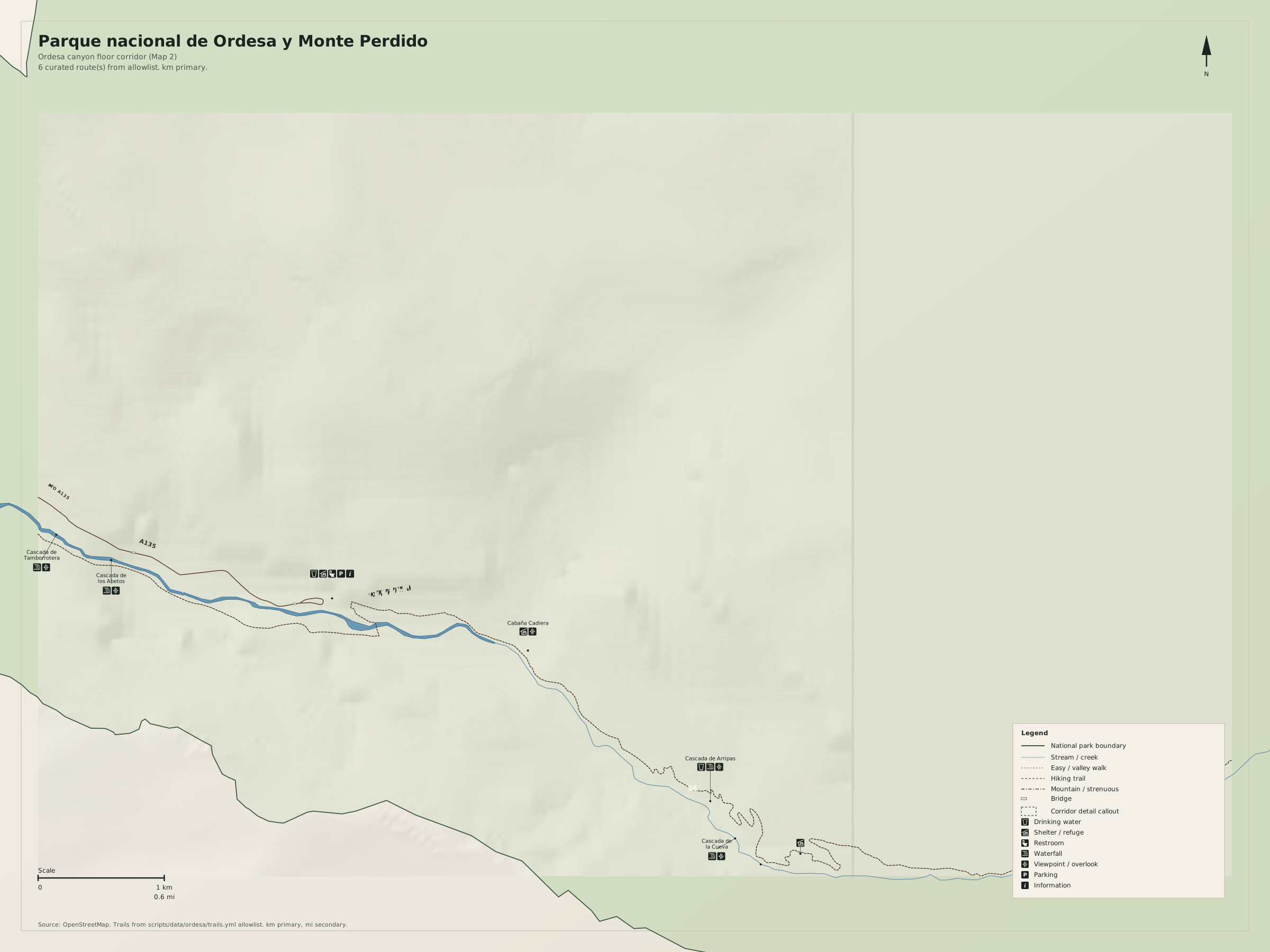
Overview
Parque nacional de Ordesa y Monte Perdido is the Grand Canyon analog in this set: a hole in the limestone, a village at the mouth, empty high ground. The dashed frame is the canyon walk.
Use Spanish toponyms as on the ground (Monte Perdido, Cola de Caballo, Torla). Distances on the map are kilometres first, miles second.
Natural highlights
What is worth seeing on foot. Elevations in meters (and feet on the map).
Monte Perdido · 3355 m
Highest limestone massif in the park (Mont Perdu). Approaches from Góriz are serious. The visitor overview is the canyon, not the summit.
Ordesa canyon
The hero landform. Most visitors walk the canyon floor toward Cola de Caballo. That walk is the dashed Map 1 frame.
Cola de Caballo
Horsetail fall at the head of Ordesa canyon. Typical turnaround for the valley walk.
Trailheads & parking
Where to leave the car (or bus) to get close to what you want to see.
Pradera de Ordesa
Shuttle or restricted vehicle access from Torla in season. Confirm the current system; do not assume you can drive to the meadow at midday in August.
Torla-Ordesa
Village lots and the shuttle hub. Gateway town, not a trailhead inside the canyon.
Pineta / Bielsa
Valley lots on the north-east side for Pineta approaches.
Trails
Distances are useful order-of-magnitude figures for planning, not survey-grade GPS tracks.
Ordesa canyon to Cola de Caballo (allowlist review)
Along the way: Ordesa canyon, Cola de Caballo
The Map 1 corridor. Faja routes above the canyon are narrower and more exposed; they are not the overview spine.
Getting there
Torla is the main gate. Pineta and Añisclo are other valleys; do not treat them as the same walk.
By car
A-23 / N-260 to Broto and Torla. Bielsa tunnel for the French side / Pineta.
By transit
Buses to Aínsa or Sabiñánigo, then local buses to Torla. Seasonal and thin.
Parking
Pradera access is managed in high season. Park in Torla and use the posted shuttle.
Intentionally left off
European tourism sites push these hard. This map does not, so the nature signal stays readable.
- Gavarnie ticketed viewpoint tourism (France, neighbour, not this sheet)
- Canyoning product maps
- Every refugio (Map 1 may name Góriz only)