Dolomiti Bellunesi National Park
The Belluno Dolomites: Schiara above the Piave, valley towns, and a sparse overview (not the whole Dolomites UNESCO map).
Maps
Park overview first. Corridor sheets add planning detail where they exist.
Park overview (Map 1)
Full map / print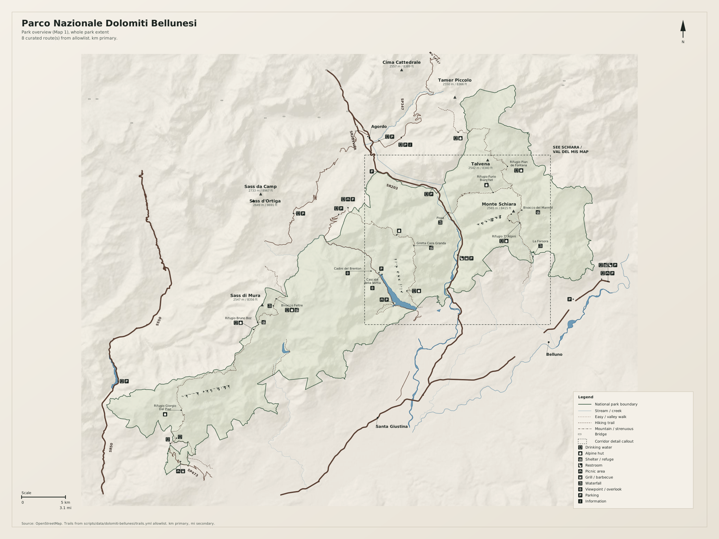
Schiara / Val del Mis corridor (Map 2)
Full map / print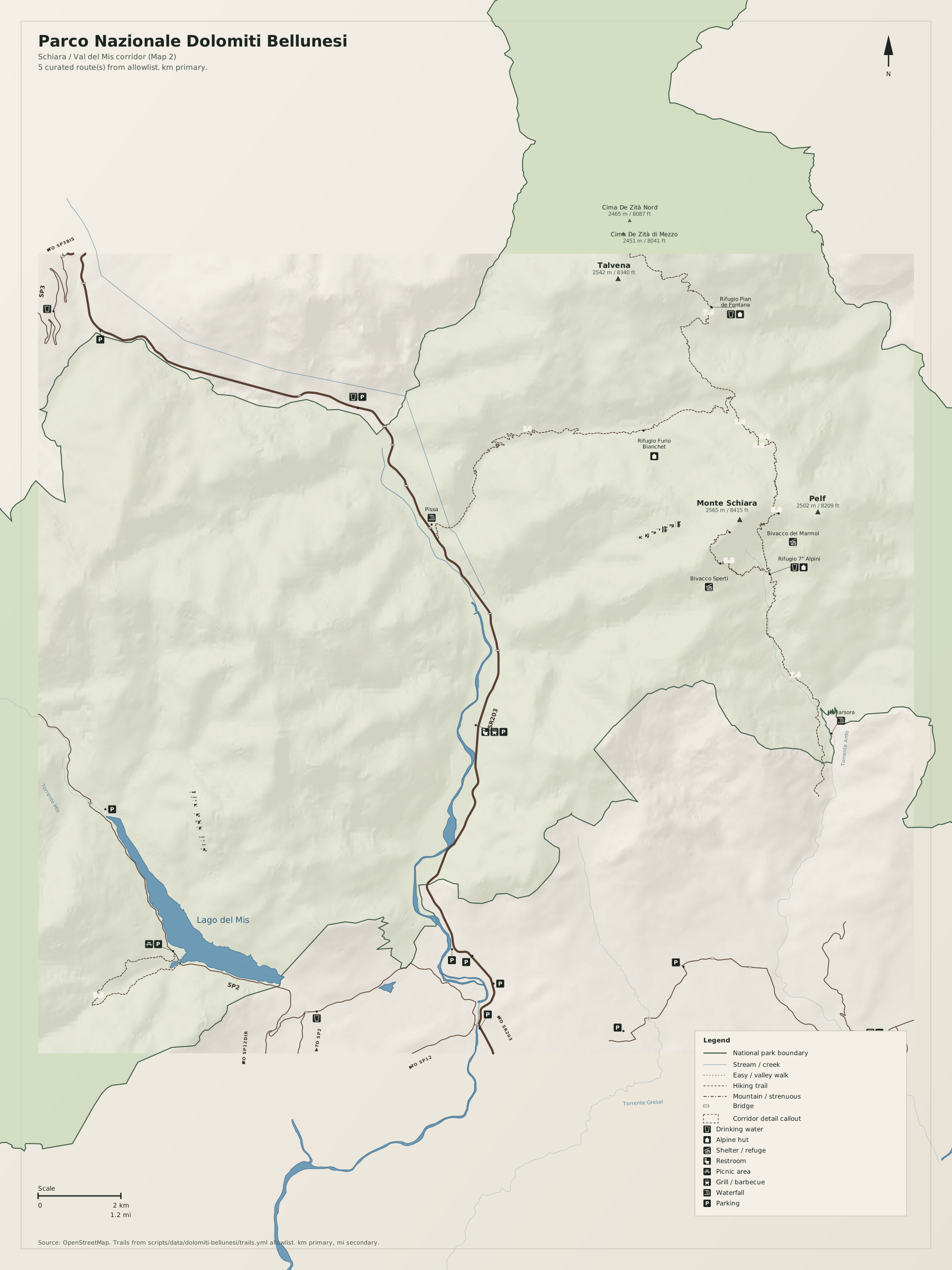
Overview
Parco Nazionale Dolomiti Bellunesi is the Teton analog in this set: a wall, valley towns, empty high ground. It is not a map of all the Dolomites.
Use Italian toponyms as on the ground. Distances on the map are kilometres first, miles second.
Natural highlights
What is worth seeing on foot. Elevations in meters (and feet on the map).
Monte Schiara · 2565 m
East wall above Belluno. Approaches via Rifugio 7° Alpini. Serious mountain hiking.
Vette Feltrine · 2336 m
Western park above Feltre (Pavione and neighbours). Quieter than the Cortina Dolomites.
Lago del Mis
Reservoir in the Mis valley. A corridor, not a wilderness lake. The dashed frame is this side of Schiara.
Trailheads & parking
Where to leave the car (or bus) to get close to what you want to see.
Case Bortot / 7° Alpini
Small valley lots north of Belluno toward Schiara. Do not block farm tracks.
Val del Mis
Roadside and lake-side lots in the Mis valley. Seasonal.
Feltre / Passo Croce d'Aune
Village and pass parking for the Vette Feltrine.
Trails
Distances are useful order-of-magnitude figures for planning, not survey-grade GPS tracks.
Schiara via 7° Alpini (allowlist review)
Along the way: Monte Schiara
Map 1 spine. Ferrata variants exist; this sheet does not grade them.
Getting there
Belluno, Feltre, and Agordo are the gateways. The park is several massifs, not one valley.
By car
A27 to Belluno; SS50 to Feltre; SR203 toward Agordo.
By transit
Trenitalia to Belluno or Feltre, then local buses. Valley buses are thin on Sundays.
Parking
Schiara trailhead lots are small. Mis valley parking is not a campground.
Intentionally left off
European tourism sites push these hard. This map does not, so the nature signal stays readable.
- Cortina / Tofane tourism (different parks)
- Via ferrata product topos
- Every malga and rifugio (Map 1 names hub huts only)